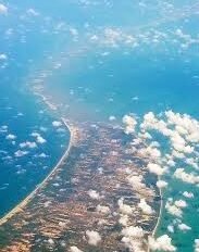
New Delhi: The Indian Space Research Organisation (ISRO) has prepared the most detailed map of Adam’s Bridge – popularly known as Ram Setu – confirming that the submerged ridge is a “continuum” from Dhanushkodi in India to Talaimannar Island in Sri Lanka.
Researchers from ISRO’s Jodhpur and Hyderabad National Remote Sensing Centres carried out the mapping exercise with National Aeronautics and Space Administration (NASA) satellite ICESat-2, which bounced laser beams off the sea floor to establish that 99.8 per cent of Adam’s Bridge was submerged in shallow water.

